Measured building surveys
Measured building surveys to maintain safety and flexibility
What We Do at GSMS
Floor plans, sections and elevations
Revealing relationships between floors, walls and different levels of a building.
Area Referencing Surveys
Measuring usable space for tenants, property owners, managers and agents.
Measured building surveys
Our measured building surveys are designed for all building types, whatever size of project: school, hospital, retail, residential or heritage site. Our clients are architects, facilities managers, M&E trades, as well as individual home owners.
GSMS’s measured building surveys are pivotal in helping clients create a ‘management handbook’ at both the construction stage and throughout the life of a building. Accurately recorded changes, alterations and refurbishments ultimately save our clients time and money.
Our first concern is to understand the purpose of the survey, then we can advise on the level of accuracy and the deliverables required. The range of data we can produce is considerable. Not every project requires the full specification but the more we understand and clarify right from the start, the more useful the survey will be to our client in the long run.
We observe industry standards in particular RICS Measured Surveys of Land, Buildings and Utilities, and Historic England best practice guides for terrestrial laser scanning. Compatibility with BIM requirements is also a facility we offer our clients. Finally, we apply our own high standard of good practice, taking care to cross reference at every opportunity thereby ensuring accuracy from the ‘whole to the part’.
We offer 2 types of measured building survey:
- Sections, elevations and floor plans
- Area Referencing

area referencing
An area referencing survey (sometimes called the ‘lease area’) gives vital information for tenants, property owners, managers and agents because it measures usable space.
There are different ways of measuring the area of a building and the choice depends upon how the measurements will be used. Gross Internal and External Areas (GIA and GEA respectively) measure the whole of a building including the thickness of walls and columns. These are more likely to be used for planning applications and building regulations. For property sales and lease negotiations, however, the Net Internal Area (NIA) will be more useful as it measures usable space. We comply with both the Royal Institution of Chartered Surveyors (RICS) code of measurement practice and the International Property Measurement Standard (IPMS).
Usable space is valuable space
Usable space is important from a leasing point of view because the majority of property costs – rent, service charge, capital value – are based on a value per square foot. As UK property is expensive, this is a critical benchmark for negotiation purposes. Usable space is defined as kitchens, cupboards and open / common areas, etc. Non usable space includes internal structural walls, columns, lifts, boiler rooms and stairwells. Tenants, property owners / managers and agents all need area referencing surveys to ensure they enter into lease agreements knowing they’re paying only for usable space.
By employing an independent expert such as GSMS, you ensure accurate and consistent measurement. The data is independent of all parties involved and both RICS and IPMS compliant which means you can also speed up your negotiations and deal-making.
the technology we use
At GSMS, we use total Stations and tablet PCs connected to laser distance meters. We observe the RICS Code of Measuring Practice which states that measurements reported in high value office space need to be ±1%. This equates to 10mm for NIAs, 50mm for GIAs.
Key points to consider
Area referencing surveys should conform to the relevant standards:
During construction (as built)
- IPMS Office 1, 2 & 3 and RICs
- Retail (ITZA) zoning surveys
- HM Land Registry compliant lease plans
- Portfolio measurement
Pre construction (off plan)
- IPMS Office 1, 2 & 3 GEA area assessments of proposed developments

Floor plans, sections and elevations
Sections and elevations reveal relationships between the floors and walls of a structure or building. It’s a measured building survey that enables our clients to realise fully their vision.
Floor plans
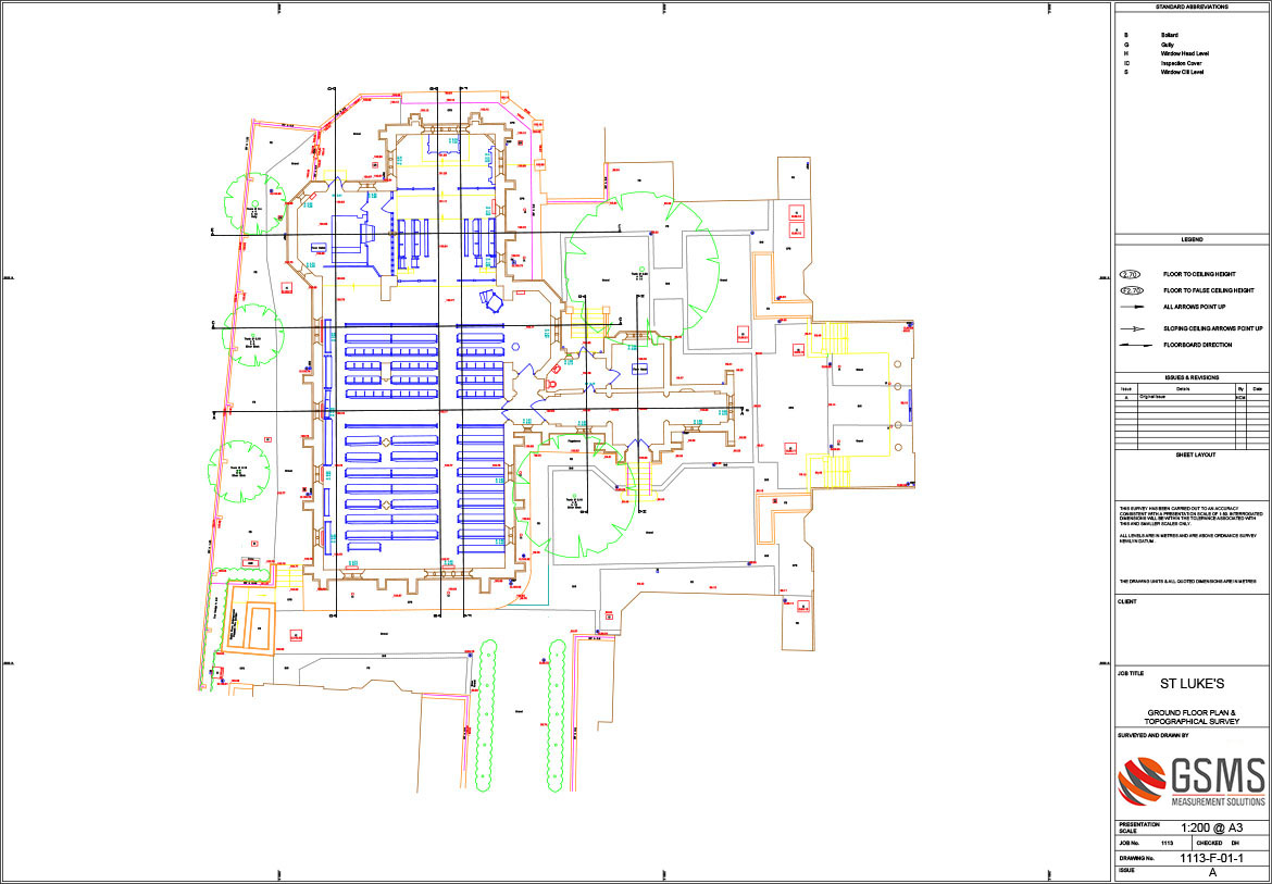
We provide the accurate data necessary to create floor plans and drawings for projects both large and small. Floor plans show the relationship between rooms, space and other features such as walls, windows and doors in each storey of a building.
Sections
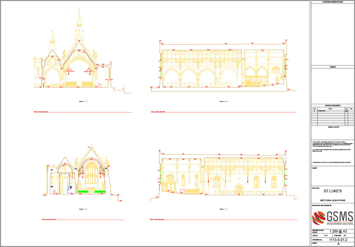
Sections (also called cross sections) show what the structure would look like if it were cut vertically to reveal the internal space. They show relationships between features that cannot be shown through floor plans. For example, a sectional elevation of an ornate window would help an architect ensure the feature is visible from different angles.
Elevations
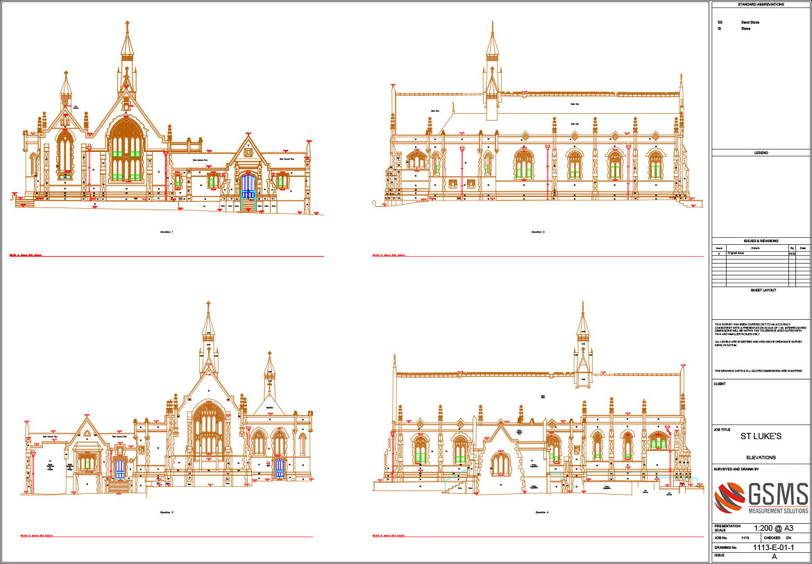
Elevations are what a building or structure looks like from the outside. They give information such as vertical dimensions, locations of doors and windows, and outside finishes. The purpose is to show the finished appearance – consequently, elevations for each side of a structure are required.
Fast, accurate drawings
We deliver fast, accurate drawings for clients building from scratch or refurbishing an existing property. These drawings enable the process of re-thinking and re-drawing to reach an efficient and satisfactory conclusion for every party. This includes the format in which we deliver the data – 2D or 3D – the latter being the most interactive, versatile and efficient.
We can work without direct physical access using non-invasive survey methods and equipment. For example, where the points to be measured are inaccessible or difficult to reach such as tower blocks or on churches frescoes and facades.
The data we provide reveals a building in its entirety. Its relationship to its surroundings – rights of light, energy rating and how it affects neighbouring buildings. It shows:
- Roof detail (heights, pitch angles, gutter locations)
- Ceiling plans (voids and service detail)
- Access data (fire escapes, windows, lifts and stairs).
Such data means the plans you submit to the local authority are more likely to be detailed, accurate and transparent.
GSMS’s measured building surveys enable other professionals to understand the property and proposed works. This avoids costly clashes between design and construction once the M&E trades start work. It means you can plan staged intervention to accommodate lighting, aircon, media cabling, etc. It also allows you to manage access issues such as the delivery of large pieces of glass or timber.
Our survey data is empowering – allowing you to think through the process, keeping on schedule and budget.
The technology we use
The majority of our elevation survey projects are undertaken using:
- Terrestrial laser scanning
- Total stations (with an accuracy of 5 arc-second)
- Photogrammetry
- Tablet PCs connected to hand held laser distance meters (and also the total station)
The Level of Detail (LoD) required is generally dictated by the project and site conditions which in turn indicates the optimum data capture method. High LoD usually involves scanners and photogrammetry. We also use total stations and tablet PCs as appropriate.
points to consider
As with every single survey GSMS undertakes, we take time to understand a client’s objectives and intentions. As mentioned above, the LoD depends upon the nature of the project and how the data will be used. So we evaluate whether the level of accuracy that can be achieved by a measured building survey is appropriate for our client’s needs – including budget. For example, a general arrangement plan is sufficient for an indication of door, window, fire points, stair locations etc. A major refurbishment or installation of off-site fabricated components (such as stairs, fittings, ceilings, curtain walls etc), however, requires a higher level of LoD.
To ensure the survey is fit for purpose, we ask the following 4 questions:
- What is the purpose of the measurement exercise?
- What are the client’s requirements and expectations in terms of accuracy and confidence in measurement?
- How do the building / site conditions at the time of survey influence how measurements are undertaken?
- What are the time / cost elements involved in the measurement and reporting?

