Topographical surveys
Measuring natural and manmade features
What We Do at GSMS
Topographical Surveys
Measuring and identifying the exact location and specifications of natural and manmade features.
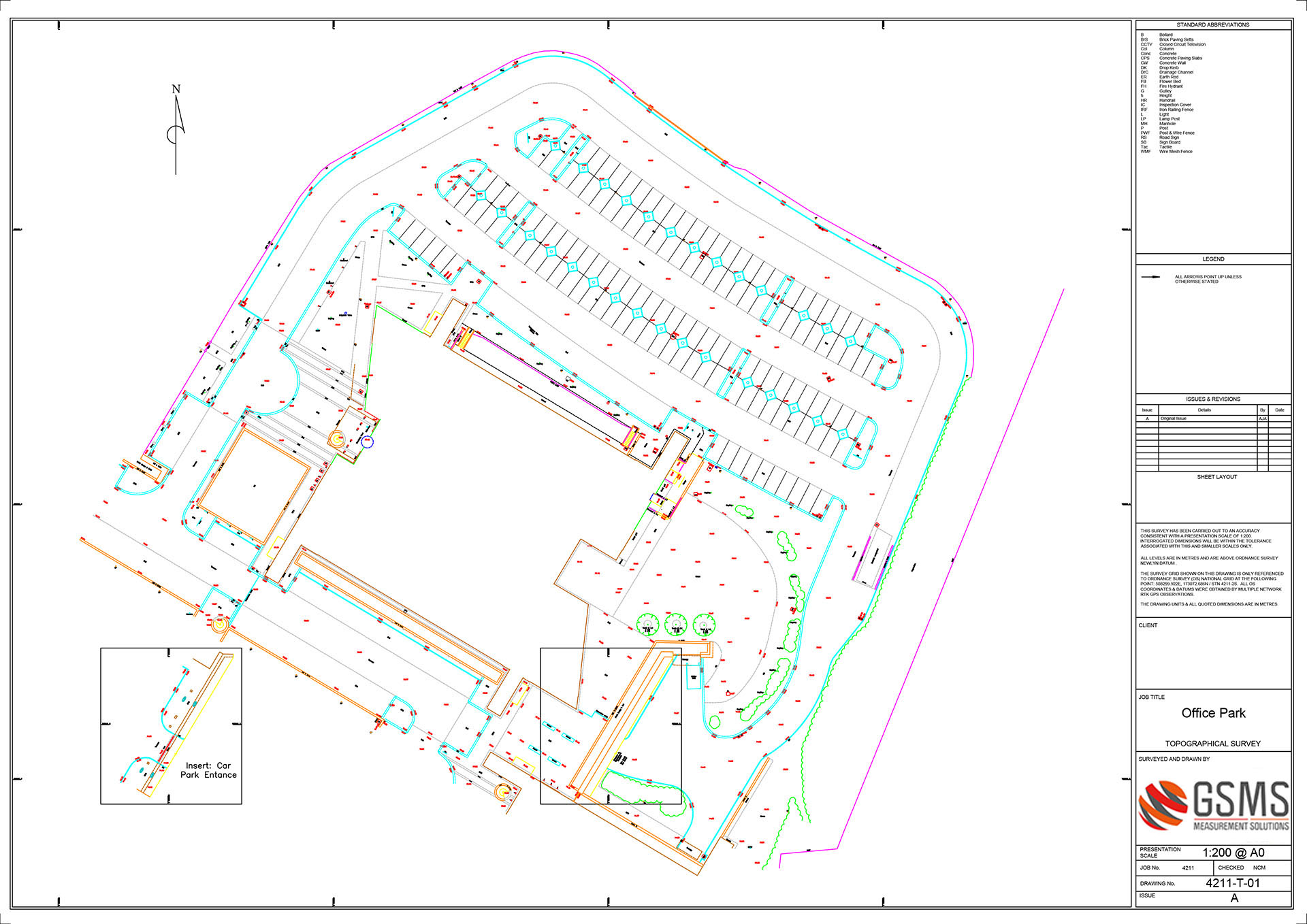
Topographical survey
Revealing vital information that might not be immediately obvious is the key reason for having a topographical survey (sometimes called a land survey). It gives an architect or engineer an accurate representation of an area. This includes all natural and manmade features, and variation in levels (eg ground level relative to OS Newlyn Datum). It’s an initial step in the design and construction process. The topographical survey data can be processed as detail maps, known as Digital Terrain Models (DTMs).
Topographical surveys detail the features (both natural and man-made) of a property, adjoining properties as well as the street concerned. For example, trees, vegetation, surface finishes, roads, street furniture, boundaries, fences, utility services and drains. This information is used by councils, architects and developers to understand what is possible in terms of design, building, land development and subdivision.
Our survey data leads to ‘better’ environments
Clients such as architects, planners and engineers, ask GSMS to perform a topographical survey at the design and planning stages of their projects. Our survey data helps them design ‘better’ environments from the outset (as in greener, friendlier, more sustainable and accessible).
For example, the presence and extent of a neighbour’s overhanging trees or the crisscrossing of overhead cables, both of which can restrict development.
We undertake PAS128 compliant methodology for underground utility surveys. This includes all four categories (D-A) where typical applications range from undeveloped land to suburban, urban and congested city areas. Better an architect has this intelligence straightaway. Any discoveries by the construction trades, at a later date, are likely to impact negatively upon timescale and budget.
A topographical survey isn’t just about protecting clients from overlooking something that costs time and money further down the line. It’s also about helping them maximise opportunities because it can uncover the potential of a project as well as its problems. Such as understanding nearby roof lines so the height of a new building is in harmony with its surroundings. Or, identifying areas prone to flooding thereby enabling designs to remedy the problem.

Contour survey
A contour survey defines important elevation data thereby revealing a ‘real world’ topographical view. It helps engineers and architects judge the suitability of a site for a planned project.
For example, contour survey data will reveal the irregularities that define the topography of an area of land. This assists a civil engineer in planning drainage ditches and flood remediation strategies. Catchment area and hence quantity of water flow at any point of a river can be found. A contour survey can locate dams, establish flood levels and determine the capacity of a reservoir.
On construction projects, the designed routes of railway, road, canal or sewer lines can be decided with the aid of a contour survey. It helps in finding out depth of cutting and filling so as to minimise and balance earthworks. The contours illustrate how land falls off around an existing property, thus demonstrating obstructions to a planned home extension.
Specialist environments – railways, highways, waterways
We work in specialist environments such as highways, waterways and railways where a topographical survey helps our clients plan large or involved projects. Essentially we help them understand fully the environment in which they are working. This, in turn, aids decision-making.
For example, a full service trace to map the position of complicated (and forgotten) infrastructure that lies beneath the ground. Relying on the information provided by the utility companies alone is insufficient because, by their own admission, they will not have complete records of where every power cable is sited, for example.
We help our clients calculate cut and fills on excavations. Calculating the quantity of soil to be removed and then required for backfill is vital data for a contractor costing out their services. We map river beds using sonar on a boat controlled remotely to reveal where rivers are silting up.
A topographical survey for highways can be used to provide an accurate layout of the road, utilities, drainage, overhead wires, nearby buildings, and other features. It can help with white line marking (eg after resurfacing work) to ensure the accuracy of the gaps – a major contribution to road safety. Similarly, our data enables housing developers to design new road junctions and pedestrian footways.
Our topographical surveys are also used for improving pedestrian access, cycle routes and major road developments. And finally, a topographical survey helps comply with important health & safety issues too. For example, protecting the workforce from unsafe buildings.

the technology we use
- Reflectorless and robotic total stations, mobile mapping, Leica GNSS equipment, terrestrial laser scanning and survey software.
- Ground penetrating radar and ultrasonics
Detailing accuracies:
- GNSS detailing
- Horizontal (H) 10-20 mm
- Vertical (V) 15-30 mm
- Total Station detailing (hard detail/soft detail)
Surveys as per current RICS codes:
- <1:100 ± 10mm/50 mm
- 1:200 – 1:500 ±50mm/100mm
- 1:1000 – ±125mm/250mm
- 1:2500 – ±500mm/1000mm
- >1:5000 – ±1000mm/2000mm
Key points to consider
- Assists with risk assessment.
- Our teams are trained to NSRWA Streetworks Unit 2 & 10 – Signing, Lighting & Guarding in accordance with Chapter 8 of the Traffic Signs Manual.
